
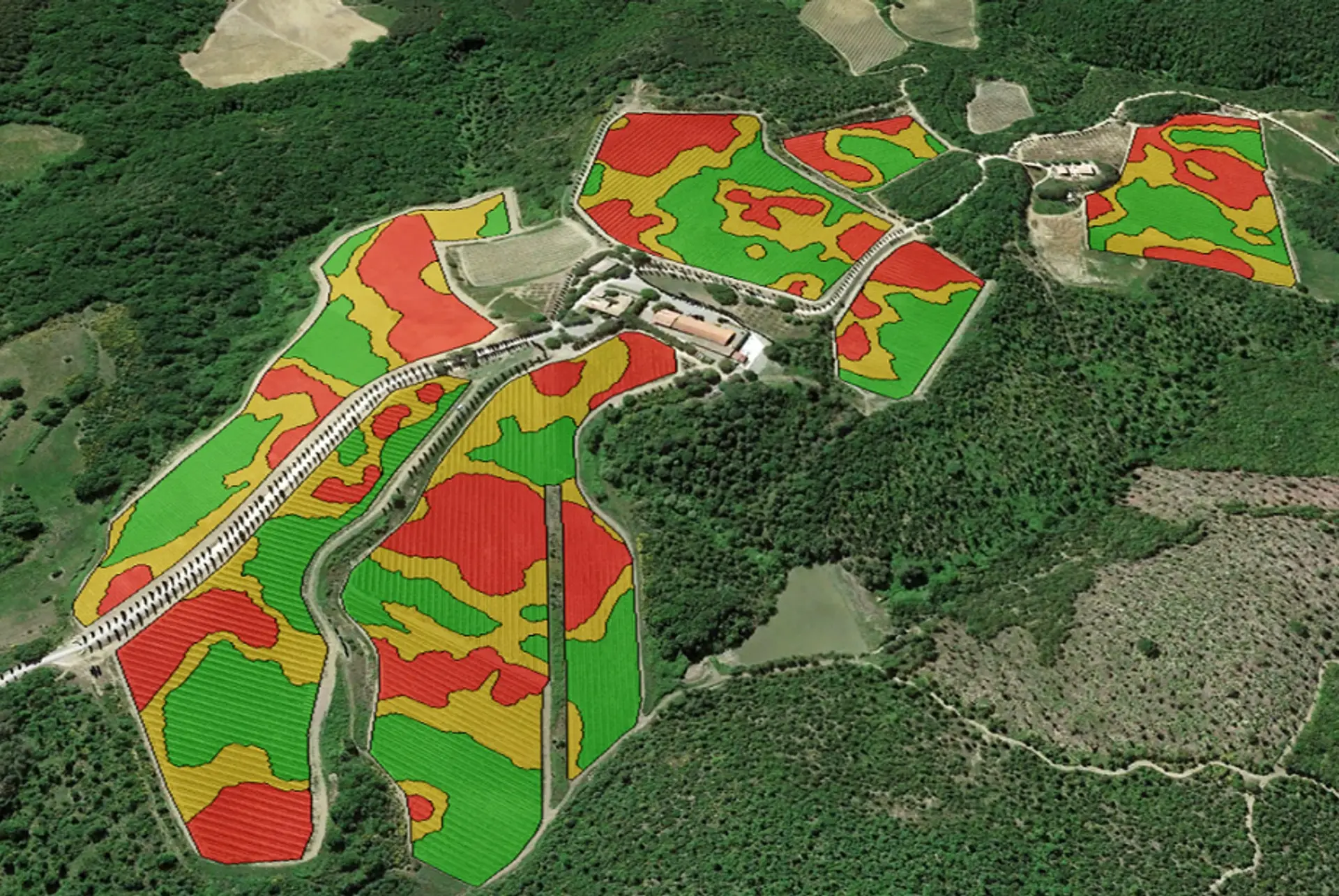
Remote sensing
iDrone · serviceOur drone survey service (Agrobit pilots included): RGB, multispectral and thermal sensors to map crops and identify the most stressed areas or those with nutrient deficiencies.
Find out more →Agritech consulting, computer vision and AI to help businesses and professionals improve production and reduce the use of inputs.
We collect data from above, interpret it with AI and give it back as guidance ready for the field.
Our drone survey service (Agrobit pilots included): RGB, multispectral and thermal sensors to map crops and identify the most stressed areas or those with nutrient deficiencies.
Find out more →Our decision-support app to manage the farm sustainably, cutting costs and increasing environmental sustainability, with no extra hardware.
Find out more →Our system of stereoscopic cameras mounted on the tractor to map yields and other agronomic parameters while you work the rows.
Find out more →Weather stations, soil sensors and predictive models that we distribute to prevent crop diseases and optimise water resources.
Find out more →Farm management software (Agricolus) to organise data and photogrammetry software (Pix4D) that we distribute to process the data collected by drones.
Find out more →Training courses on precision agriculture and digital farming and the transfer of innovation and knowledge.
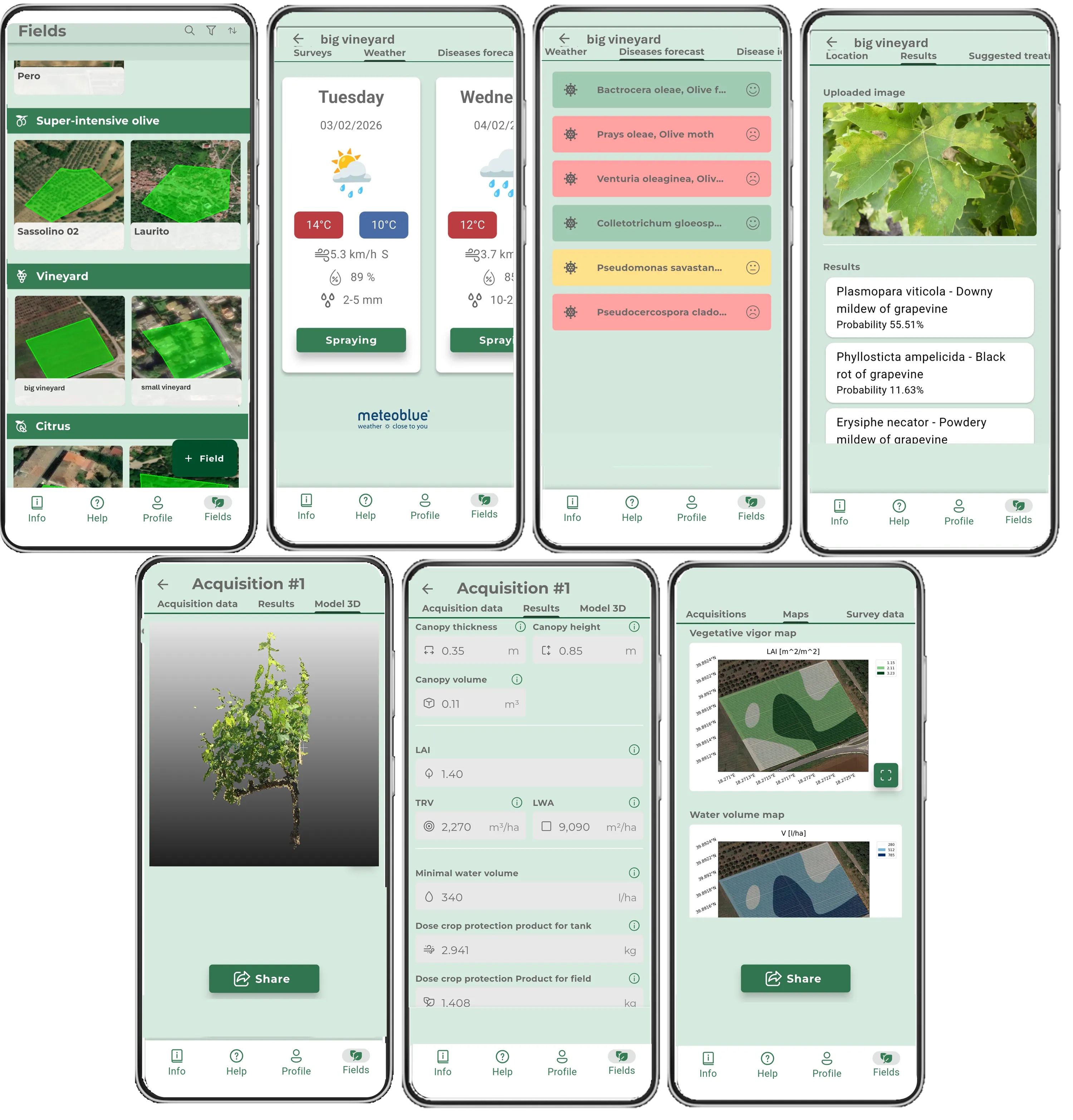
Find out more →The first DSS app to support agronomic decisions simply, quickly and affordably, using only your smartphone!
A single partner to bring precision agriculture to your business, from data to decision.
From software (iAgro) to hardware (drones, sensors) through to the field service: all integrated, with agritech consulting and ongoing support from a single point of contact.
Technologies awarded at national and European level, born of more than 10 years of applied research and tested in the field.
Engineering, agronomy and ICT at your side, with years of experience in precision agriculture.
Produce more using less water, fertilisers and plant protection products, with objective data and targeted interventions.
The results of those who use Agrobit solutions to guide their decisions in the field:
Use of plant protection products and water, with peaks of up to -50% in the early phenological stages
Increase in yield and product quality
*Maximum estimates, based on years of field research.





Thanks to Agrobit's drone services we have been able to improve the nitrogen fertilisation of our vineyards to help achieve a better production balance while at the same time avoiding creating excesses in the more vigorous areas. In addition, we used the vegetative vigour maps to support a more selective harvest, thereby improving the quality of our wines
We have worked with Agrobit for many years, using the drone maps to optimise the harvest. Thanks to the zoning of vegetative vigour, we can select and separate the grapes more effectively in order to obtain wines of superior quality. At a cost that is more than sustainable even for a small business like ours (3 hectares), we manage to draw tangible benefits from the technology
With Agrobit's drone services equipped with a multispectral camera we have been able to map a large part of our vineyards quickly and precisely. These surveys are extremely useful for taking an X-ray of the vineyards' state of health and gaining a greater spatial understanding of the more or less critical areas, useful for better directing our agronomic efforts

Thanks to the thermal and multispectral drone surveys of our super-intensive olive groves, we have been able to map water stress and critical points, obtaining valuable information for irrigation management. The drone is a unique tool for monitoring hilly areas quickly

We have been able to experience first-hand the potential offered by the drone, a tool capable of monitoring fragmented surfaces in a short time and at a contained cost and of giving us a unique view from above. The vegetative vigour maps helped us to assess the state of our vineyards, hit hard by downy mildew, and to better direct our agronomic efforts to improve productivity

Despite being an operation of about 10 hectares, thanks to Agrobit's drone services we have been able to map the vegetative vigour of our vineyards and optimise fertilisation and harvest. In addition, we were able to objectively verify the effectiveness of some operations such as inter-row cover cropping, useful for reducing water stress on the rows
Our vineyards are very fragmented and small in size. In this context, where quality is the main objective, the drone with a multispectral camera proves to be a very versatile and fast tool. The data obtained thanks to Agrobit was used to carry out a zoning of vegetative vigour and objectively assess the state of the vineyards
With Agrobit we carried out flights with a drone equipped with a multispectral and thermal camera to get an overview from above of part of our vineyards. The aim was to monitor their condition and water stress in order to design a precision irrigation system to improve yield

Thanks to Agrobit's drone flights we have been able to improve our agronomic decisions with objective data, improving fertilisation and harvest

Using Agrobit's drone-and-thermal-camera flight service we have been able to quickly map the temperatures and water stress of our olive groves and improve irrigation

Thanks to Agrobit's drone services, we have been able to obtain useful information extensively and quickly for the field trials of our testing centre. The drone's monitoring potential, combined with advanced data-analysis algorithms, made it possible to objectively assess the effectiveness of the various products tested in the field
We have worked with Agrobit on vineyard, orchard and wheat over several years of experimentation. The drone services with multispectral and thermal cameras made it possible to assess the functional state of the vegetation, validated with point measurements on the ground. In addition, we were able to use the mappings to optimise the soil-moisture monitoring network, better positioning the FDR sensors in the field under study

We have collaborated with Agrobit on vineyard, olive grove and almond grove in various trials linked to research projects under the PSR Puglia. The drone services with multispectral and thermal cameras were particularly useful, combined with ground measurements, for assessing the health conditions of the plots across a broad spectrum

We collaborated with Agrobit on vineyard in the Puviot project of the PSR Puglia over 3 years of experimentation. The drone services with multispectral camera were used to map more than 10 plots between northern Puglia and Salento and assess their state of vigour









Tell us about your business: we'll show you how iAgro, iTractor and iDrone can help you produce more using fewer resources.