
- Precision agriculture
- Remote sensing
- NDVI
- NDRE
- GNDVI
- OSAVI / TCARI
- LAI
- LWA
- TRV
- CWSI
- VRA (Variable rate)
- DSS
- Digital twin
- Prescription map
- Vigour map
- Aerial photogrammetry
- Orthophoto / Orthomosaic
- DEM / DSM
- Multispectral sensor
- Thermal imaging
- Agrometeorology
- Disease-prediction model
- Evapotranspiration
- GNSS / RTK
- ISOBUS
- Management zone
- Yield estimation
- 3D canopy scanning
- Stereoscopic camera
- Agricultural carbon footprint
- Agronomic API
- Low-volume drone treatment
- Georeferencing
- LIDAR
- Point cloud
- Ground Control Point
- Ground Sample Distance
- Payload
- Flight plan
- Spectral band
- Spectral signature
- NDMI
- EVI
- Fertigation
- Conservation agriculture
- Precision seeding
- Satellite auto-steering
- Section Control
- Farm telemetry
- FMIS
- Agricultural traceability
- Soil carbon sequestration
- Crop growth model
- Soil electrical conductivity
- Field capacity and wilting point
- Crop water requirement
- Water balance
- Phenology
- Artificial intelligence in agriculture
- Agriculture 4.0
- Agricultural IoT
- Plant-protection intervention threshold
- Precision viticulture
- Selective harvesting
- Copernicus / Sentinel
- Precision agriculture
-
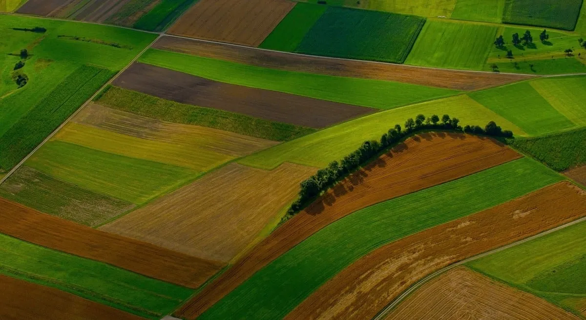
An approach to crop management that uses georeferenced data (from drone, satellite, sensors and app) to intervene in a targeted way zone by zone, dosing water, fertilisers and plant protection products according to the real needs of each part of the field rather than uniformly.
The Agrobit solutions → - Remote sensing
-
Remote detection of crop characteristics through sensors mounted on drone, aircraft or satellite. The images in the different bands (visible, near-infrared, thermal) make it possible to estimate vigour, water stress and health status without direct contact with the plant.
iDrone service → - NDVI Normalized Difference Vegetation Index
-
A vegetation index that measures vigour and the amount of green biomass by combining the red and near-infrared bands. It takes values from -1 to +1: the higher it is, the denser and more active the vegetation. It is the most widely used index for vigour maps.
Guide to vegetation indices → - NDRE Normalized Difference Red Edge
-
An index that exploits the red-edge band, more sensitive than NDVI in dense-canopy crops and in the advanced phases of the season. It is useful for assessing nitrogen status and distinguishing differences in vigour when NDVI tends to saturate.
NDVI vs NDRE → - GNDVI Green Normalized Difference Vegetation Index
-
A variant of NDVI that uses the green band instead of the red. It is more sensitive to chlorophyll content and is used to assess nutritional status and variations in vigour in crops with high leaf cover.
- OSAVI / TCARI Optimized Soil Adjusted / Transformed Chlorophyll Absorption
-
Indices that reduce the influence of the soil (OSAVI) and estimate the chlorophyll content (TCARI). Often used together, they improve the reading of vigour in woody crops where the ground between the rows can distort traditional indices.
- LAI Leaf Area Index
-
Leaf area index: the ratio between the total leaf surface and the ground surface occupied. It is an objective parameter of canopy density, useful for calibrating treatment volumes and assessing crop vigour.
The iAgro app → - LWA Leaf Wall Area
-
Leaf wall area: the surface of the "wall" of vegetation per unit length of the row, typical of trellised vineyards and orchards. It is used to adapt the plant-protection-product dose to the actual canopy volume to be treated.
- TRV Tree Row Volume
-
Tree row volume: the canopy volume per hectare, calculated from height, thickness and planting layout. It is one of the reference methods for determining the water volume and the product dose in sprayers.
- CWSI Crop Water Stress Index
-
Crop water stress index, calculated from thermal images: it compares canopy temperature with air temperature to identify plants under water stress. It supports precision irrigation, watering only where needed.
Guide to water stress → - VRA (Variable rate) Variable Rate Application
-
Variable-rate application: the distribution of water, fertilisers or plant protection products with a dose that varies automatically zone by zone of the field, following a prescription map, to optimise inputs and reduce waste.
What is VRA → - DSS Decision Support System
-
Decision support system: a tool that collects agronomic data (weather, sensors, images, predictive models) and translates it into practical guidance on protection, nutrition and irrigation. The iAgro app is a DSS for smartphone.
iAgro, the mobile DSS → - Digital twin Digital Twin
-
A digital replica of a crop or a field, built from images and collected data. It makes it possible to measure plant parameters, simulate scenarios and monitor the evolution over time without physically intervening in the field.
- Prescription map
-
A map that divides the field into zones and assigns each one the optimal dose of an input (fertiliser, plant protection product, seed, water). It is loaded onto the on-board terminals to guide the machines in variable-rate applications.
VRA with iTractor → - Vigour map
-
A colour representation of the variability of vegetative vigour within a plot, obtained from the vegetation indices. It highlights the more and less productive areas to manage harvesting, fertilisation and treatments in a site-specific way.
- Aerial photogrammetry
-
A technique that reconstructs three-dimensional models and georeferenced maps from many overlapping aerial photos taken by the drone. It is the basis of orthophotos, 3D models and vegetation-index maps (e.g. with Pix4D software).
- Orthophoto / Orthomosaic
-
An aerial image corrected geometrically so that each point is represented as seen from above and at uniform scale, like a map. Obtained by combining (mosaicking) many drone photos, it allows accurate measurements of distances and surfaces.
- DEM / DSM Digital Elevation / Surface Model
-
Digital models of the ground elevation (DEM, bare soil) and of the surface including vegetation and structures (DSM). Derived from photogrammetry, they are used for analyses of slope, water runoff and canopy volumes.
- Multispectral sensor
-
A sensor able to capture images in several bands of the electromagnetic spectrum beyond the visible (e.g. near-infrared, red edge), mounted on a drone or satellite. It is the basis for calculating vegetation indices such as NDVI and NDRE.
iDrone service → - Thermal imaging Thermal sensor
-
Detection of the canopy's surface temperature via a thermal infrared camera. It picks up variations linked to water stress and the early stages of some diseases, before they are visible to the naked eye.
- Agrometeorology
-
The application of weather data (temperature, humidity, rainfall, wind) to agronomic decisions: forecasting the risk of fungal diseases, calculating water needs and planning treatments, based on local weather stations or high-resolution satellite data.
Weather in iAgro → - Disease-prediction model
-
A mathematical model that estimates the risk of a disease or pest developing based on weather, phenological and pathogen-biology data, producing a risk index that anticipates the appearance of symptoms by several days, allowing preventive and targeted intervention.
Disease prediction in iAgro → - Evapotranspiration ET0 / ETc
-
The amount of water lost through soil evaporation and crop transpiration over a given period. ET0 is the reference value calculated from weather data, ETc is the value corrected for the specific crop and growth stage: it is the base parameter for scheduling irrigation.
- GNSS / RTK Global Navigation Satellite System / Real-Time Kinematic
-
Satellite positioning systems; real-time RTK correction reduces the position error to a few centimetres. It underlies automatic tractor guidance and the accurate positioning of surveys and maps.
- ISOBUS
-
A communication standard (ISO 11783) that lets tractor, on-board terminal and implement (spreader, sprayer, seeder) exchange data uniformly, regardless of manufacturer, so a prescription map can be loaded onto the terminal and applied automatically in the field.
VRA and ISOBUS → - Management zone
-
A delimited part of a field because it shows soil and vigour characteristics that are uniform within it and different from other zones. It is the unit on which prescription maps are built to differentiate fertilisation, irrigation and treatments.
- Yield estimation
-
An early forecast of expected production (number and size of fruit or bunches) using computer vision on images captured by smartphone or drone, useful for planning harvest, logistics and marketing before picking or harvest.
Yield estimation in iAgro → - 3D canopy scanning
-
A three-dimensional reconstruction of a plant or row from photos taken with a smartphone, used to measure the height, thickness and volume of vegetation (parameters such as LAI, TRV and LWA) without dedicated instruments.
3D scanning in iAgro → - Stereoscopic camera
-
A pair of cameras that, capturing the same scene from two viewpoints, reconstruct image depth. Mounted on a tractor, they make it possible to continuously measure canopy volume and estimate yield while passing through the field.
iTractor → - Agricultural carbon footprint Carbon footprint
-
The net amount of CO2 equivalent associated with a farm's activities, calculated by subtracting the absorption by crops and soil from the emissions (machinery, fertilisers). It is increasingly required across supply chains for sustainability reporting.
Sustainability at Agrobit → - Agronomic API Application Programming Interface
-
An interface that automatically transfers agronomic data (surveys, maps, indices) from an app or DSS platform to farm management software, ERPs or third-party supply-chain systems, avoiding manual entry and duplication.
- Low-volume drone treatment
-
The distribution of plant protection products or biological agents (e.g. beneficial insects) by drone, with lower mixture volumes than traditional machinery. Useful on sloped land, hard-to-reach crops and for fast, localised interventions.
Drone distribution → - Georeferencing
-
Assigning precise geographic coordinates to a piece of data, an image or a map, so it can be correctly overlaid with other information layers (cadastral boundaries, previous maps, orthophotos). It is the prerequisite for comparing surveys carried out at different times.
- LIDAR Light Detection and Ranging
-
A remote-sensing technology that measures distances by emitting laser pulses and analysing the return time of the reflected signal. It reconstructs the three-dimensional structure of canopy and terrain with great precision, even under dense vegetation where photogrammetry alone struggles.
Surveys with iDrone → - Point cloud
-
A set of millions of points in three-dimensional space, each with X, Y, Z coordinates, generated by photogrammetry or LIDAR. It is the raw representation from which 3D models, canopy heights and volumes are derived.
- Ground Control Point GCP
-
A point on the ground with precisely known geographic coordinates, used to calibrate and georeference drone or satellite surveys with centimetre-level accuracy.
- Ground Sample Distance GSD
-
The real-world ground size represented by a single pixel of an aerial or satellite image. The lower the value (e.g. a few centimetres), the greater the image detail.
- Payload
-
A drone's useful load, i.e. the set of sensors and cameras (RGB, multispectral, thermal) mounted for the survey. The choice of payload determines which data can be collected during the flight.
- Flight plan
-
The route, altitude, speed and shot-point sequence programmed for a drone before the mission, to ensure uniform coverage of the area and the image overlap needed for photogrammetry.
- Spectral band
-
A defined range of light wavelengths (e.g. red, green, blue, near-infrared, red edge) that a multispectral sensor can detect separately. Combining several bands generates the vegetation indices.
- Spectral signature
-
The reflectance profile of an object (a plant, soil, water) measured across different spectral bands. Healthy and stressed plants show different spectral signatures: this is the principle behind remote diagnosis.
- NDMI Normalized Difference Moisture Index
-
An index that estimates vegetation moisture content by combining the near-infrared and shortwave-infrared bands. It complements CWSI for monitoring the plant's water status.
- EVI Enhanced Vegetation Index
-
A variant of NDVI that corrects for atmospheric influence and reduces signal saturation in very dense canopies, offering a more accurate reading of vigour under high-biomass conditions.
- Fertigation
-
A technique that distributes fertilisers dissolved in irrigation water, often drop by drop. Combined with prescription maps, it allows water and nutrients to be dosed together, zone by zone.
- Conservation agriculture
-
An agronomic approach based on minimum tillage, permanent soil cover and crop rotation, to preserve soil structure and fertility. Precision-agriculture data helps monitor its effects over time.
- Precision seeding
-
Distributing seeds at a variable rate and controlled spacing based on the productive capacity of each field zone, to optimise planting density and reduce seed waste.
- Satellite auto-steering
-
A system that, using a GNSS receiver (often with RTK correction), automatically guides the tractor along parallel passes with minimal overlap, reducing overlaps and skips during treatments.
iTractor → - Section Control
-
A function that automatically switches individual sections of the spray boom or spreader on and off when they are over already-treated areas or off the field, avoiding overlaps and product waste.
iTractor → - Farm telemetry
-
Remote transmission, in real time or delayed, of farm machinery operating data (position, fuel consumption, working hours, alarms) to a management platform, to monitor the machine fleet remotely.
- FMIS Farm Management Information System
-
Software platform that centralises a farm's field, machinery, treatment and production data, supporting activity planning and reporting.
- Agricultural traceability
-
The ability to reconstruct the path of a product, the treatments and the crop practices applied, from the field to the supply chain. Data collected through precision agriculture strengthens the traceability required by specifications and large-scale retail.
- Soil carbon sequestration
-
The process by which soil retains organic carbon removed from the atmosphere, favoured by practices such as conservation agriculture and cover cropping. It is a key element in calculating agricultural carbon footprint.
- Crop growth model
-
A mathematical model that simulates a crop's development (phenological stages, biomass accumulation, expected yield) based on weather, genetic and agronomic data, useful for planning interventions and estimating production.
- Soil electrical conductivity ECa
-
A measurement that reflects soil texture, moisture and salinity. Recorded with towed sensors or from satellite, it is often the basis for delimiting a field's first management zones.
- Field capacity and wilting point
-
The two limits that define the water available to a plant in the soil: field capacity is the maximum water retained after drainage, the wilting point is the level below which the plant can no longer absorb it. Key parameters for scheduling irrigation.
- Crop water requirement
-
The amount of water a crop needs at a given phenological stage to grow without stress, calculated from evapotranspiration and specific crop coefficients.
- Water balance
-
The accounting between water inputs (rainfall, irrigation) and losses (evapotranspiration, percolation) over a given period, used to decide when and how much to irrigate.
- Phenology
-
The study of a plant's development stages (budburst, flowering, fruit set, ripening) in relation to environmental conditions. Knowing the current phenological stage is essential for calibrating treatments and predictive models.
- Artificial intelligence in agriculture
-
The use of machine-learning algorithms to recognise patterns in agronomic images and data, for example to identify diseases from a photo, forecast yields or automatically classify crops.
A real-world application → - Agriculture 4.0
-
The paradigm of connected, digitalised agriculture that integrates sensors, IoT, robotics, big data and artificial intelligence into production processes, promoted in Italy also through dedicated tax incentives.
Funding and opportunities → - Agricultural IoT Internet of Things
-
A network of connected sensors and devices in the field (weather stations, moisture probes, counters) that continuously collect and transmit data, feeding decision-support systems in real time.
iAgro → - Plant-protection intervention threshold
-
The level of pest presence or disease risk beyond which a treatment becomes economically and agronomically justified, underpinning integrated pest management.
- Precision viticulture
-
The application of precision-agriculture principles to the vineyard: vigour maps, NDVI/NDRE indices, selective harvesting and variable-rate treatments to make the most of a vineyard's natural variability in terms of grape quality.
Maps and models for winegrowers → - Selective harvesting
-
Grape harvesting differentiated by vineyard zone based on vigour or ripeness maps, to separate batches with different quality characteristics and allocate them to different products.
Selective harvesting with the drone → - Copernicus / Sentinel
-
The European Union's Earth-observation programme; the Sentinel-2 satellites, in particular, freely provide multispectral images with a 5-day revisit time, widely used in precision agriculture for large-scale monitoring.
Satellite maps in iAgro →