
Prescription maps and VRA: what is variable rate application
Prescription maps and VRA: what is variable rate application
Introduction
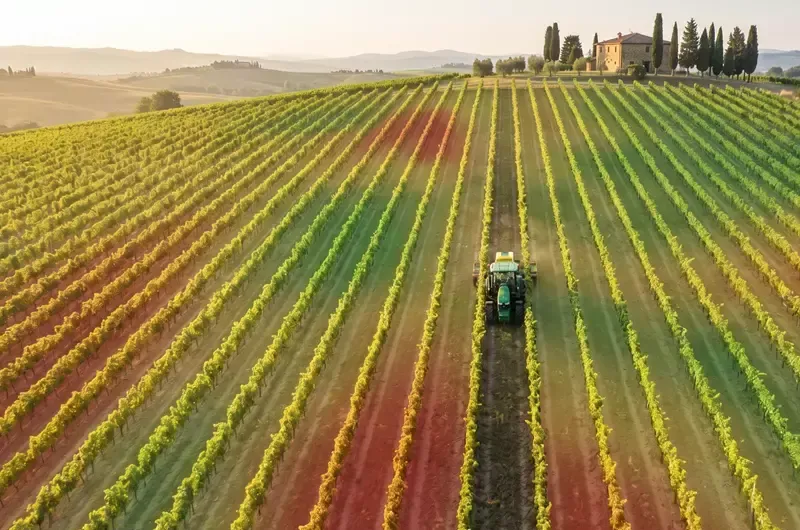
Prescription maps are the cornerstone of operational precision agriculture: they turn a multispectral image, sensor data or a yield map into concrete instructions for the tractor. Various ISMEA and CREA analyses indicate that a uniform dose of fertilisers and pesticides is still the standard across much of Italian agriculture today, despite the fact that internal variability within individual plots is frequently significant. VRA (Variable Rate Application) reverses this logic: it doses only where needed, and only as much as needed. This operational guide explains what a prescription map is, how it is generated, how it is transferred to an ISOBUS tractor, and how much is actually saved in vineyards, olive groves, orchards and arable crops.
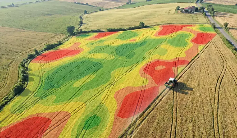
Fig.1: VRA prescription map for a vineyard: the colour zoning tells the tractor the variable dose to distribute in each sub-area.
What a prescription map is and what it solves
A prescription map is a georeferenced file that divides a plot into homogeneous zones and assigns each zone a specific dose of an agronomic input (fertiliser, water, pesticide, seed). It is the “recipe” that the agronomist hands over to the operating machine so that it distributes different quantities at different points in the field, replacing fixed-dose logic with calibrated-dose logic.
The map solves a very concrete problem: internal variability within Italian plots is almost always high. Differences in soil texture, effective depth, exposure, microclimate, planting age and vegetative vigour mean that the same quantity of nitrogen or crop protection product produces very different effects just a few metres apart. Distributing uniformly therefore means under-dosing in poorer zones and over-dosing in richer ones, with waste on both fronts.
15-30%: Typical reduction range in pesticide and fertiliser consumption reported in technical literature and in European precision agriculture case studies applied to vineyards, orchards and arable crops managed with prescription maps (source: analysis based on CREA technical review and Eurostat data on chemical input use, 2024).
Standard formats of a prescription map
Prescription maps are distributed in two format families: GIS vector formats (.shp shapefile, GeoJSON, KML) and machine-tractor interchange standards (ISO-XML, part of the ISOBUS / ISO 11783 standard, and proprietary formats from manufacturers such as John Deere, CNH and Claas). Good practice is to generate the map as a shapefile for storage and archiving, and convert it to ISO-XML for transfer to the machine.
VRA: Variable Rate Application explained simply
VRA (Variable Rate Application) is the technique by which an operating machine adjusts the distributed dose in real time, following the instructions of a prescription map or an on-the-go sensor. It is the “operational arm” of precision agriculture: without VRA, a map remains a cartographic exercise; without a map, VRA is blind.
Operationally, the VRA system works as follows. The tractor receives the georeferenced prescription map; a GPS receiver (ideally RTK, with centimetre-level precision) reads its position moment by moment; an ISOBUS controller operates the valve of the fertiliser spreader, sprayer or seed drill, varying the dose or delivery rate depending on the zone being crossed. The operator only has to drive: the machine adjusts itself.
VRA for fertilisation, irrigation and crop protection
Variable rate applications fall into five main categories, each with a different level of technological maturity and adoption in Italy:
- VRA fertilisation: the most mature. Centrifugal and pneumatic spreaders accept ISO-XML maps and dose nitrogen, phosphorus or potassium according to zoning (vigour, historical yield, soil analysis).
- VRA crop protection treatments: sprayers and booms with variable-rate or individual-section nozzles, controlled by a control unit and a map, dose fungicides and insecticides according to leaf mass or risk.
- Variable rate sowing: precision seed drills adjust sowing density according to soil capacity, particularly useful in maize and cereals.
- Precision irrigation: sector-based sprinkler systems and drip lines with zoned valves deliver differentiated volumes based on CWSI maps and soil moisture.
- Selective harvesting: grape harvesters and pickers with product separation systems into different hoppers, activated by the vigour or quality map.
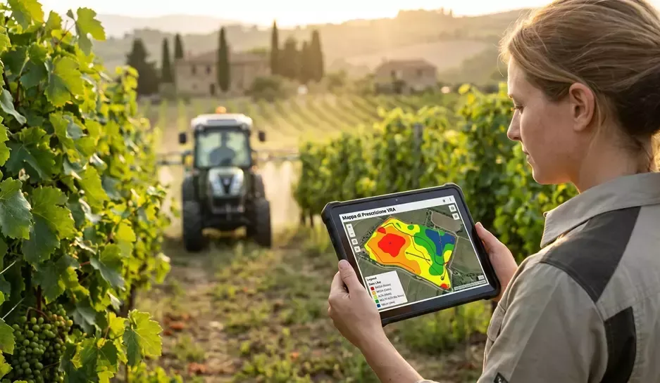
Fig.2: Variable rate application in a vineyard: the tractor follows the prescription map and adjusts the dose zone by zone.
VRA for selective harvesting
VRA is not just about inputs: it also applies to the season’s output. In viticulture, selective harvesting is now the main lever for adding value to quality wine. A pre-harvest NDRE map divides the vineyard into zones of different vegetative-productive balance; the harvester or picking teams direct the grapes into separate batches. The same logic applies to premium olives and pome fruit. For a documented practical case, it is worth reading Agrobit’s in-depth article on using drone maps for selective grape harvesting.
From data to map: the operational workflow
The process that takes raw data to an operational prescription map involves four stages, each with technical choices that affect the final quality.
Stage 1: data acquisition
There are many usable data sources. Drones provide multispectral orthomosaics with a resolution of 2-10 cm/px, NDVI/NDRE indices and thermal maps for CWSI. The Sentinel-2 satellite provides free images at 10 m resolution every 5 days, useful for cereals and large areas. Field sensors (weather stations, soil moisture probes, leaf wetness sensors) return continuous point data. Historical yield maps from georeferenced combine harvesters are often the most solid basis for multi-year production zoning.
Stage 2: zoning and prescription
The clustering algorithm (typically k-means or fuzzy segmentation) divides the field into 3-5 homogeneous zones for the parameter of interest. The choice of number of zones is a trade-off between agronomic detail and the operating machine’s ability to handle rapid transitions: 3 zones work well for standard spreaders, while 5-7 zones require more advanced ISOBUS equipment and individual-section booms. The agronomist assigns each zone a specific dose based on a protocol (soil analysis, crop offtake, forecasting models, regulatory constraints). For nitrogen fertilisation, for example, low-vigour zones may receive higher doses to recover productivity or, conversely, lower doses if the limiting factor is structural; the choice depends on the farm’s objective (maximum yield vs. quality balance).
Stage 3: transfer to the machine
The map is exported in ISO-XML or in a proprietary format compatible with the tractor’s monitor, transferred via USB, SD card or the cloud (Agrirouter, MyJohnDeere, Climate FieldView and similar), and loaded into the job controller. In the field, the operator starts the operation: the system automatically manages the doses by following GPS position.
2-3 cm: Typical positioning accuracy of an RTK GPS receiver in precision agriculture, compared with 30-50 cm for a standard differential GPS and 2-5 m for a consumer GPS. This gain is critical for VRA on narrow rows and for auto-steer (source: GNSS technical documentation for agriculture, Eurostat-JRC Agri Data Hub, 2024).
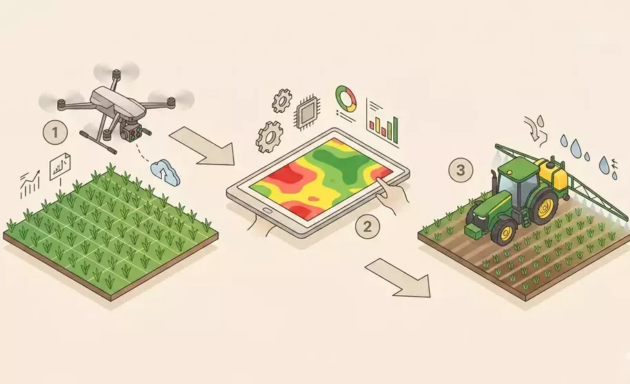
Fig.3: The VRA workflow in three steps: drone acquisition, prescription map generation, variable rate application in the field.
Tractor compatibility and the ISOBUS standard
The ISOBUS standard (formally ISO 11783) is the communication protocol between tractor, equipment and monitor that makes VRA possible in an interoperable way, regardless of brand. A certified ISOBUS tractor communicates with any certified ISOBUS equipment via a standardised 7-pin cable, exactly like a smartphone with a USB-C charger.
What you need on the tractor
To do “real” VRA, you need four components: a GPS receiver (ideally RTK, with a base station or regional CORS network for centimetre-level precision), an ISOBUS monitor with a VRC (Variable Rate Control) or Task Controller licence, compatible equipment (spreader, sprayer, seed drill, boom), and a compliant ISOBUS cable. The initial investment is significant but scalable: many Italian agricultural contractors already offer a “turnkey” service to farms that don’t want to invest in their own hardware.
When the tractor isn’t ISOBUS
For machinery fleets not yet ISOBUS-equipped, intermediate solutions are available: retrofit kits with universal monitors (Trimble, Topcon, John Deere, Hexagon) that interface with the pneumatic or hydraulic valves of existing equipment. Performance is lower than a native system, but sufficient for fertilisation and treatments across 3-5 zones. For continuous monitoring during field operations, systems such as iTractor with stereoscopic cameras add a layer of computer vision that can also be integrated onto older tractors.
How much you save with VRA: numbers and ROI
The economic benefits of VRA depend on three variables: the field’s actual variability, the unit cost of the input, and the size of the plot. Under average Italian conditions, the savings documented in technical literature and European case studies fall within the following ranges.
- VRA nitrogen fertilisation: a 10-20% saving on nitrogen distributed for the same yield, with reduced leaching losses and compliance benefits with respect to the Nitrates Directive and CAP eco-schemes.
- VRA crop protection treatments: a 15-30% saving on the quantity of product distributed, especially in vineyards and orchards where leaf mass variability is high.
- Precision irrigation: water savings in the order of 20-40% in the most virtuous situations, particularly significant in regions with growing water stress such as Puglia, Sicily, Sardinia and Emilia-Romagna.
- Variable rate sowing: yield increases of 3-8% in maize and cereals on plots with highly variable soil texture, for the same seed cost.
Beyond the direct saving on inputs, VRA produces indirect benefits that are often even more significant: a reduced carbon footprint for the business (relevant to the CSRD directive and sustainability reports), access to the 2023-2027 CAP eco-schemes that reward precision agriculture, better product quality and greater uniformity in PDO/PGI supply chains.
-20%: Fertiliser use reduction target by 2030 set by the European Green Deal’s Farm to Fork strategy; VRA and prescription maps are among the key tools identified at institutional level to achieve this target at farm level (source: European Commission, Farm to Fork strategy communication, reaffirmed in the Agri 4.0 PNRR plans, 2023).
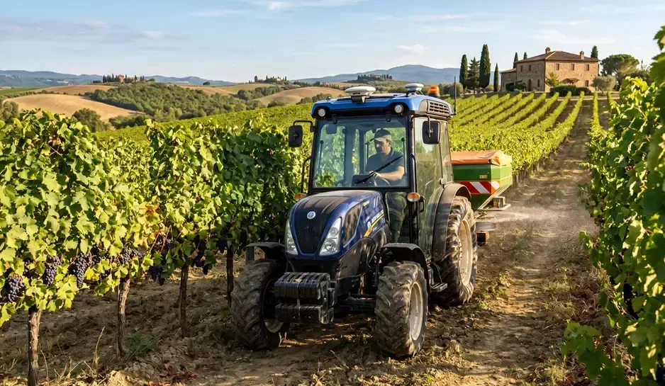
Fig.4: VRA application in a vineyard.
When VRA isn’t worth it
VRA is not always the right choice. On very small plots (under 2-3 hectares), very homogeneous ones, or those with low input intensity (e.g. traditional extensive olive groves), the costs of data acquisition, map generation and ISOBUS hardware can outweigh the benefits. The practical rule is to assess internal variability: if two points 50 metres apart in the same field require the same intervention, the map is pointless; if they require different interventions, VRA pays off.
Common mistakes when applying prescription maps
Field experience highlights five recurring mistakes that reduce or eliminate the value of VRA. Knowing them helps avoid frustration and ineffective investment.
- Zoning that is too fine: splitting the field into 8-10 zones on equipment that can only handle 3 transitions per second creates delivery instability and average doses not very different from uniform application.
- Data that is too old: an NDVI map from a month ago may no longer represent the current situation, especially during rapid development stages or after weather events. Maps need to be kept up to date.
- Lack of ground validation: interpretation of remote data must always be checked against an agronomic field visit. A “red” zone could be water stress, a fungal attack, a root problem, or poor soil: the prescription changes radically depending on which it is.
- Poorly managed data transfer: files in incompatible formats, projection errors, wrong coordinate systems. These seem like details, but they bring the operation to a halt.
- Untrained operator: the ISOBUS monitor requires specific skills. Without training, even the best VRA system gets switched off by the operator after the first problems.
To avoid these mistakes, many Italian businesses choose to rely on specialised agricultural contractors or integrated services that manage the entire data-map-application chain. Agrobit, for example, supports cooperatives, agricultural contractors and structured businesses in designing the end-to-end operational workflow.
Frequently asked questions about prescription maps and VRA
What is a prescription map in agriculture?
A prescription map is a georeferenced file that divides an agricultural plot into homogeneous zones and assigns each zone a specific dose of an input (fertiliser, water, pesticide, seed). It is the “recipe” that the tractor or sprayer follows to distribute different quantities at different points in the field, replacing a uniform dose.
What format does a VRA map use (shapefile, ISO-XML)?
The most common formats are the shapefile (.shp + .dbf + .shx + .prj) for GIS storage and management, and ISO-XML (ISO 11783 standard) for transfer to the ISOBUS tractor. Proprietary formats from some manufacturers also exist (John Deere, CNH, Claas, Trimble). Good practice is to generate the map as a shapefile and convert it to ISO-XML at the point of use.
Do you need a specific tractor for VRA?
You need a tractor with a certified ISOBUS interface, a monitor with a Task Controller VRC licence, and a GPS receiver, preferably RTK, for centimetre-level precision. For non-ISOBUS tractors, retrofit kits with universal monitors (Trimble, Topcon, Hexagon) are available, allowing VRA across 3-5 zones with acceptable performance.
How much can you save with variable rate fertilisation?
Data reported in European technical literature indicates a 10-20% saving on nitrogen distributed for the same yield, with additional compliance benefits with respect to the Nitrates Directive and the 2023-2027 CAP eco-schemes. The figure varies depending on field variability and crop intensity: very homogeneous plots show more modest savings.
Can VRA also be used for crop protection treatments?
Yes, and it is one of the fastest-growing areas. Sprayers with variable-rate nozzles, individual-section booms or nebulisers with electronic flow meters dose fungicides and insecticides based on leaf mass measured by sensors or a preventive prescription map. Documented savings reach 15-30% on the quantity of product distributed.
Can prescription maps be made with a smartphone?
Partly, yes. DSS apps such as iAgro generate vigour maps from RGB photos and Sentinel-2 data, which can become the basis for a simple prescription map (3 zones) exportable as a shapefile. For professional VRA on ISOBUS sprayers and spreaders, the prescription map is still generated in a GIS environment and transferred to the machine via ISO-XML.
Want to activate VRA on your farm?
Agrobit supports farms, cooperatives and agricultural contractors from the drone survey through to the prescription map, all the way to transfer onto the operating machine. With iTractor, we monitor during field operations; with iDrone, we generate high-precision multispectral maps. Talk to one of our technicians to build the operational workflow suited to your supply chain.
▶ Contact an Agrobit technician ▶ Explore the Agrobit blog
Also read more about solutions for agricultural cooperatives and applications of drone treatments in agriculture.